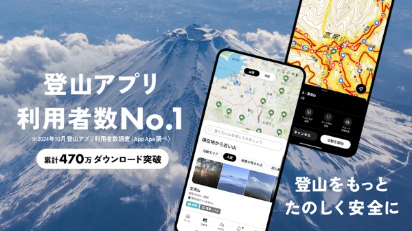
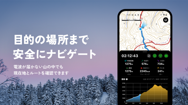
YAMAP is Japan’s most popular outdoor navigation app, designed to enhance trekking, hiking, and skiing experiences with advanced GPS tracking and detailed maps. Unlike traditional navigation apps, YAMAP functions without a mobile signal, ensuring users can safely explore remote mountainous regions. With features like elevation tracking, parking information, and trailhead locations, YAMAP provides essential tools for outdoor enthusiasts while allowing them to document and share their adventures.
Key Features
Offline GPS Tracking & Navigation
- Signal-Free Functionality – Track and log outdoor activities even in areas without mobile coverage.
- Accurate Positioning – Utilize YAMAP’s detailed maps and smartphone GPS for precise location tracking.
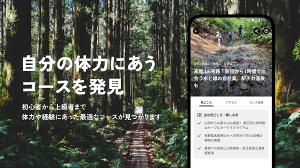
- Elevation & Trailhead Information – Access essential data for safe and informed trekking.
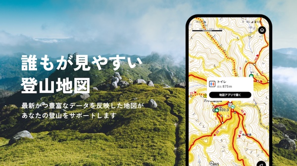
Convenient Digital & Paper Maps
- Smartphone Integration – Use digital maps for real-time navigation.
- Downloadable Paper Maps – Print maps from a PC or tablet for offline reference.
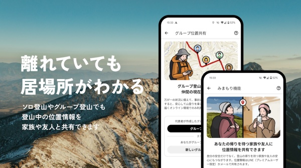
Activity Sharing & Online Journals
- Comprehensive Activity Reports – Save and upload trekking routes, workout history, and outdoor data.
- Family & Friends Sharing – Share hiking experiences with loved ones through YAMAP’s platform.
Wear OS Compatibility
- Smartwatch Integration – Pair with a smartphone for real-time elevation and distance tracking.
- Trail Display – View trekking routes directly on the Wear OS screen.
Awards & Recognition
- Good Design Special Award (2014) – Recognized for innovation in outdoor navigation.
- Red Herring Top 100 Global Winner (2017) – Honored for technological excellence.
- National Park Official Partner (2017) – Endorsed by Japan’s Ministry of the Environment.
Why Choose YAMAP?
- Provides offline GPS tracking for safe outdoor exploration.
- Offers detailed maps with elevation, parking, and trailhead information.
- Enables users to document and share trekking experiences with family and friends.
Frequently Asked Questions
Q: Does YAMAP work without a mobile signal?
A: Yes, YAMAP functions using GPS and offline maps, making it ideal for remote locations.
Q: Can I print maps from YAMAP?
A: Yes, users can download maps to a PC or tablet for printing.
Q: Does YAMAP support smartwatches?
A: Yes, YAMAP is compatible with Wear OS for real-time tracking.
Q: Can I share my trekking routes with others?
A: Yes, users can upload and share activity reports with family and friends.
Q: Where can I find more information about YAMAP?
A: Visit the official website at yamap.com for updates and details.
Version History
v10.18.10 ---- 14 Apr 2025
- Bug fixes and improvements.
v10.17.15 ---- 17 Apr 2024
- Bug Fixes and improvements.
v10.17.11 ---- 21 Mar 2024
- Bug fixes and improvements.