Fulcrum GIS Field Data Capture is a powerful mobile GIS platform designed to streamline field workflows and enhance data accuracy. With intuitive features and AI-powered tools, Fulcrum empowers teams to efficiently collect, manage, and share geospatial data for various industries.
Key Features
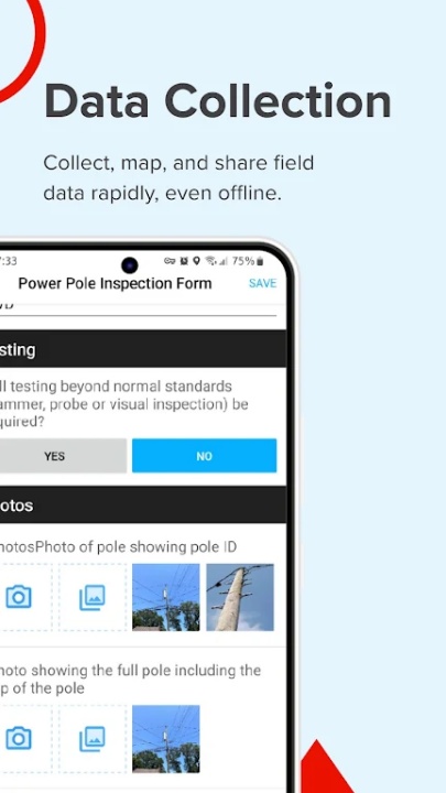
Real-Time GIS Data Collection
- Capture accurate geospatial data with mobile applications tailored for field use.
- Streamline surveys, inspections, and compliance tracking with real-time data synchronization.
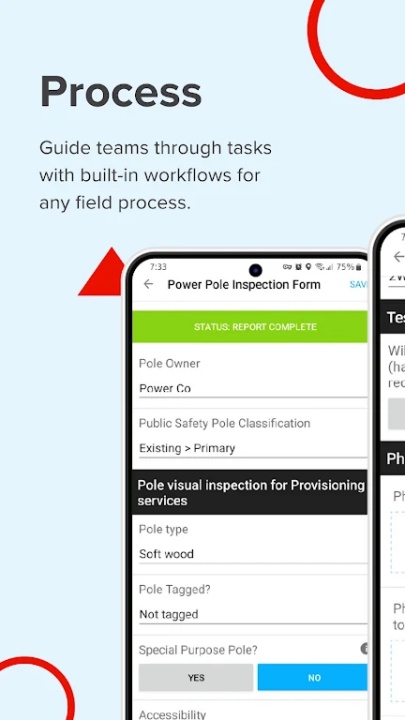
Customizable Form Builder
- Use the drag-and-drop form builder to create and customize inspection checklists, surveys, and asset tracking forms.
- No coding required, making it accessible for both GIS experts and non-GIS team members.
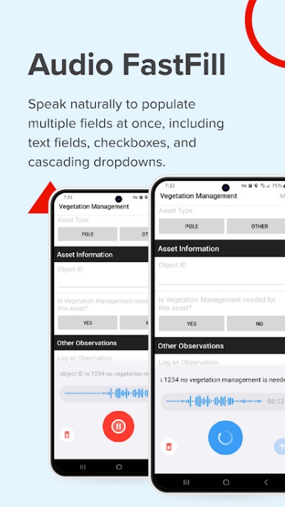
AI-Powered Voice Data Entry
- Leverage Audio FastFill for hands-free data collection, reducing manual input and speeding up fieldwork.
- Enhance productivity with AI-driven automation for structured data capture.
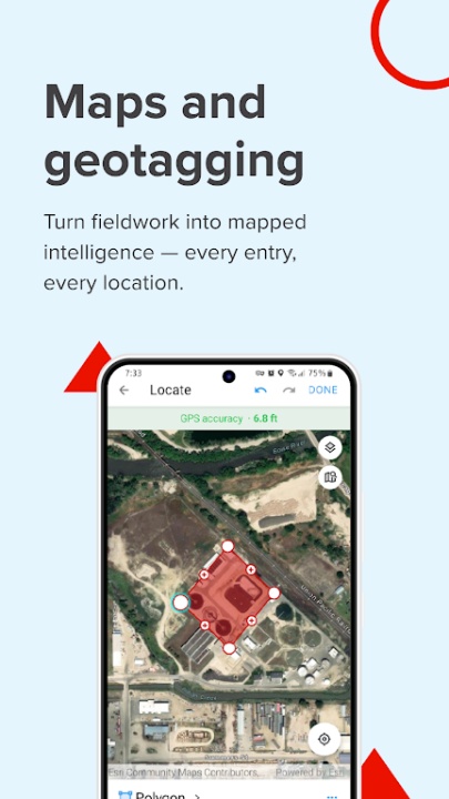
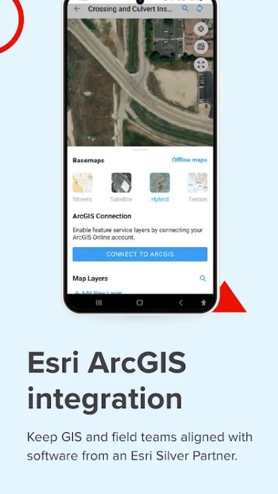
Integrated GIS Capabilities
- Sync seamlessly with Esri ArcGIS and export geospatial data in formats like GeoJSON or Shapefiles.
- Enhance mapping, reporting, and decision-making with precise location data.
Offline Data Collection
- Capture and store data without internet connectivity, then sync once back online.
- Ensure uninterrupted workflows in remote or low-connectivity areas.
Advanced Security Features
- Protect sensitive data with SOC 2 Type 2 compliance, single sign-on (SSO), and customizable user roles.
- Simplify onboarding with SCIM integration for secure and efficient user management.
Dedicated Support and Native Mobile Apps
- Access full functionality on Android devices, optimized for serious field use.
- Receive expert assistance via email, chat, or phone for seamless support.
Why Choose Fulcrum GIS Field Data Capture?
- Trusted by nearly 3,000 companies and over 50,000 users worldwide for digitizing field data collection.
- Integrates seamlessly with GIS workflows, reducing manual processes and improving data accuracy.
- Designed for industries like construction, utilities, environmental services, and more.
Industries and Use Cases
Land Surveying and Field Inspections
- Capture precise GPS data and sync in real-time for accurate land surveys and inspections.
Utility and Infrastructure Management
- Track and manage assets with GIS mobile data collection and automated reporting.
Environmental Monitoring and Compliance
- Conduct site assessments, collect location-based data, and generate reports with ease.
Construction and Engineering Projects
- Manage site audits, inspections, and progress tracking with mobile data collection tools.
Frequently Asked Questions
Q: Can Fulcrum be used offline?
A: Yes, Fulcrum allows offline data collection, which can be synced once back online.
Q: Does Fulcrum integrate with Esri ArcGIS?
A: Absolutely, Fulcrum syncs seamlessly with Esri ArcGIS and supports geospatial data exports.
Q: Is Fulcrum suitable for non-GIS team members?
A: Yes, Fulcrum is designed to be user-friendly for both GIS experts and non-GIS users.
Q: What industries benefit from Fulcrum?
A: Fulcrum is ideal for construction, utilities, environmental services, and other field-focused industries.
Q: Does Fulcrum offer secure data management?
A: Yes, Fulcrum ensures data security with SOC 2 Type 2 compliance, SSO, and customizable user roles.
Version History
v4.19.0 ---- 22 Apr 2024
- Bug fixes and improvements.
v3.0.4 ---- 4 Feb 2024
- Bug Fixes and improvements.
v2.41.3 ---- 14 May 2022
- Bug fixes and improvements.