BalticMaps is a comprehensive mapping app offering detailed maps and data of the Baltic States—Latvia, Lithuania, and Estonia. Designed for both casual users and professionals, BalticMaps provides a range of features to enhance navigation, exploration, and geographic understanding.
Key Features
Free Version Features
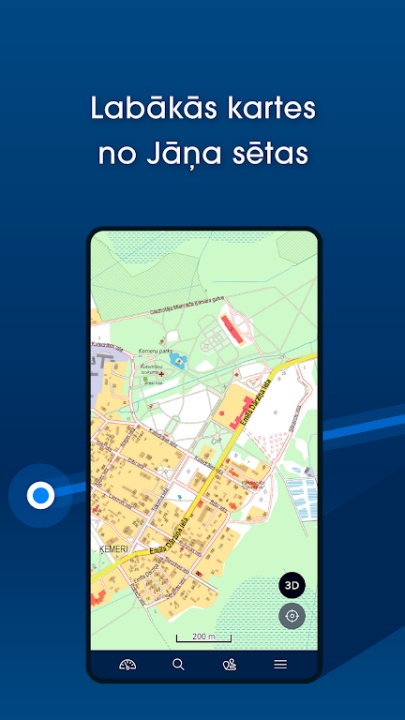
- Browse digital raster and vector maps of Latvia, Lithuania, and Estonia created by Jana seta.
- Use GPS functionality to pinpoint your location and view the closest address with WGS/LKS-92 coordinates.
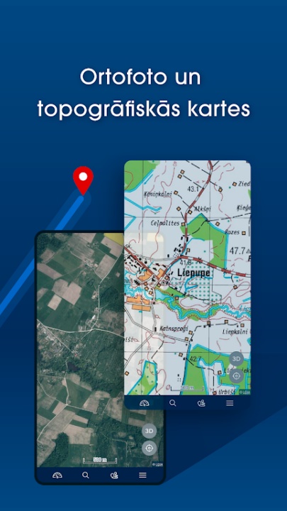
- Access contemporary and historical topographic maps of Latvia.
- Explore orthophoto maps of Latvia and Estonia for detailed aerial views.
- Share locations and report map data errors or changes directly through the app.
Full Version Features
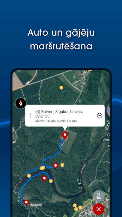
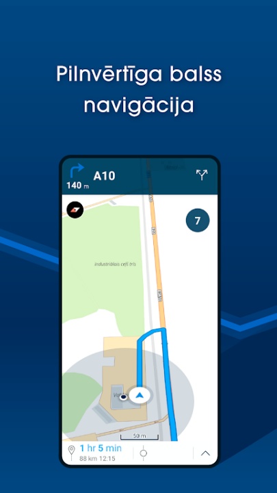
- Unlock turn-by-turn navigation with voice guidance for cars and pedestrians, supporting up to 50 waypoints.
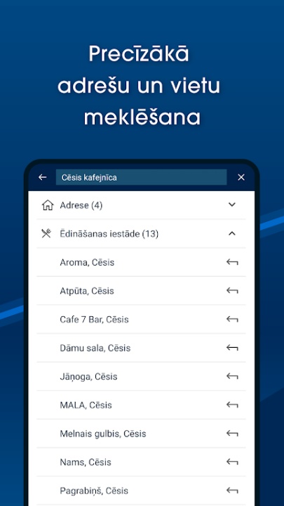
- Search for addresses, places, rivers, lakes, and more across the Baltic States.
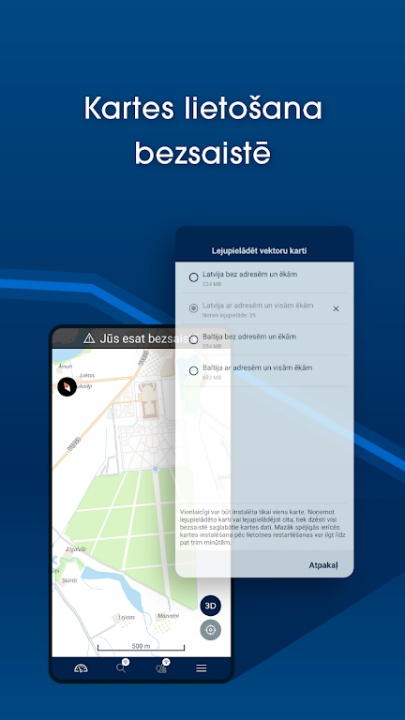
- Download offline vector maps for uninterrupted access.
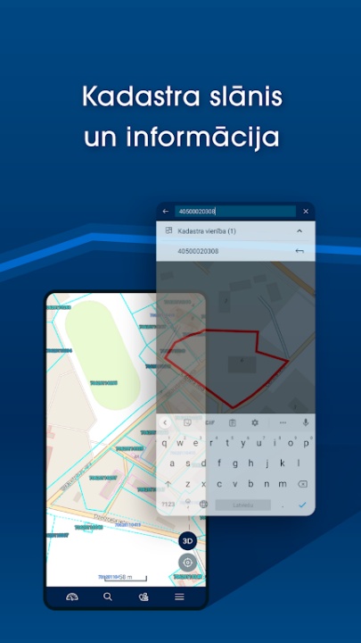
- Access cadastre information and search for cadastral parcels and buildings in Latvia.
- View live traffic updates in Riga and Pieriga, refreshed every five minutes.
- Bookmark favorite places for quick access.
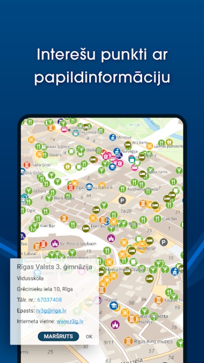
- Discover points of interest, speed cameras, and long-distance hiking trails like the Forest Trail and Baltic Coastal Hiking Route.
- Import GeoJSON, GPX, or KML files to view custom data on the map.
Why Choose BalticMaps?
- Combines detailed mapping with advanced navigation tools for a superior user experience.
- Offers offline functionality and live traffic updates for convenience and reliability.
- Provides access to unique features like cadastre information and historical maps.
Frequently Asked Questions
Q: Can I use BalticMaps offline?
A: Yes, the full version allows you to download and use offline vector maps.
Q: Does BalticMaps provide live traffic updates?
A: Yes, live traffic information is available for Riga and Pieriga, updated every five minutes.
Q: What types of maps are included in the free version?
A: The free version includes digital raster and vector maps, as well as contemporary and historical topographic maps of Latvia.
Q: Can I import custom data into BalticMaps?
A: Yes, you can import GeoJSON, GPX, or KML files to view custom data on the map.
Q: How can I subscribe to the full version?
A: Subscriptions are available on a yearly basis and require a Google Account for payment.
Version History
v4.2.5 ---- 20 Apr 2025
- Bug fixes and improvements.
v4.2.3 ---- 17 Jan 2025
- Bug Fixes and improvements.
v4.2.2 ---- 28 Dec 2024
- Bug fixes and improvements.